
Mountaineering in the North
- Phonganrazi Ice Capped Mountain Expedition
- Mt. Khakarborazi -The King of South East Asia Expedition
Phonganrazi Ice Capped Mountain Expedition
Duration - 17 Days
Best time - From October to May
Grade - Rigorous, Mid-hill trekking
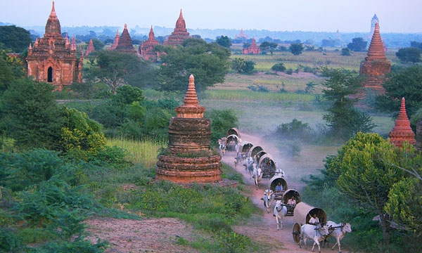
Phongan Razi Mountain is situated in Putao Township, northernmost part of Myanmar. Phongan Razi Mountain is easiest one among ice and snow capped mountains in Myanmar. Except in August and September the mountain is capped with ice and snow all year round. Fongunrazi Mountain is 11500 feet (3505 meter) high and located between N latitude 27 5' and E longitude 97. Today Ministry of Forestry designated the region around Phongan Razi Mountain as Phongan Razi Wildlife Sanctuary.
Day 1: Putao - Upper Shan Kaung by car
Depart for Upper Shan Kaung by car about 4 hours drive. Upper Shan Kaung is a big village and it has over 200 houses. Overnight at village houses.
Day 2: Upper Shan Kaung -WarSar Dam - 14 miles
Early departure for WarSar Dam. About 10 hours hiking today. On the way, passing by Mt SinLite Martin mountain (6206 feet high) the path crossing over 5000 feet high of its ranges. The path is getting a bit steep near the top of Mountain Range. The journey will be slow as the ridges are wet. The forest became thicker and there were evergreen hard wood forests. Soon after, get the summit of Partip Mountain. WarSar Dam village has only 10 houses. If your group less than 10 people that will be possible to stay at village houses.
Day 3: WarSar Dam - Awa Dam - Lona Dam - ZiYar Dam - 13 miles
Hiking through flat and plain region for 13 miles today. On the way, there is a ZiYar river near Awa Dam (Lisu) village. Pass over a 400 feet long rattan suspension bridge and then observed a pleasant forest and later will arrive at Lona Dam village. The rattan suspension bridge is useful in raining season and when water level is high. If there is no raining and water level is low, there is a bamboo bridge built on river stones.
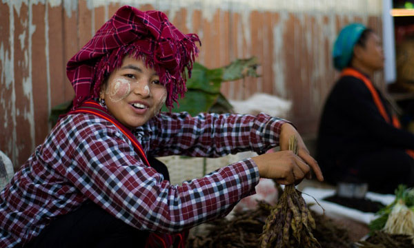
Left Lona Dam village and continue journey to ZiYar Dam village about 7 miles. ZiYar Dam village is in the north-western most part of Myanmar, which is nearest to the Phongan Razi mountain, 3,300 feet above the sea. There are 18 houses in the village. Most of the villagers are Rawan, Lisu and Lisu- Rawan national races. Their livelihood is cultivation and hunting. Overnight at ZiYar Dam village.
Day 4: ZiYar Dam - Chaung Sone camp (River confluence)
Trekking about 7 miles Up and down hill slopes and crossing several streams along the way. You will cross small Phongan River before confluence of Phongan and NamLan rivers. Normally it is possible to walk through to the other side, if water level is high that we need to cut trees and make a bridge. It is better to make pre arrangement if river need to build a bridge. Soon or later, we will get to confluence and camping for overnight.
Day 5: Chaung Sone Camp - ThitPin Gyi Camp
Leaving Chaung Sone camp in the morning. Crossing over Phongan River again. Today we are going to climb onto over 6000 thousand feet high. Along the way, the orchids growing on trees and branches where the forest became dense and the slope became deep and trekking is slow. When we get higher the forest is changing with pines and rhododendron trees. In the evening arrive our camp.
Day 6: ThitPin Gyi Camp - Yekhe Ahsat or Ice Camp
Today will be hard trekking about over 6 miles. First depart for KhanTaunMit (or) KyantLu Ai camp at 8260 feet above sea. And continue journey to Ice camp. Depend on weather condition, ice and snow line of demarcation is changing. When it is more snow, you are going to trek on ice after KyantLu Ai camp of 8260 feet. Due to severe cold, all of the trees have shed their leaves and there were only dry branches on the trees. The ground was covered with ice and no more orchids could be seen growing on the trees. Finally you will get to ice line where to stop overnight. Find a place to pitch camps.
Day 7: Ice camp - To the summit
From the camp to Summit will take 3 to 6 hours depend on location of your ice camp. If it is good weather, you will have time about an hour or more and if it is bad weather not more than 30 minutes. Return to Ice camp.
Day 8: Ice camp - Chaung Sone camp
The whole day trekking down to camp. If there is full of water in Phongan River that we need to stop for overnight near the river and cross the river next day. Overnight at camp.
Day 9: Chaung Sone camp - ZiYar Dam village
Return along same route. It is a great opportunity to celebrate a party for your memorable and successful trip at village.
Day 10: ZiYar Dam - WarSar Dam village
Day 11: WarSar Dam - Upper Shan Kaung
Day 12: Upper Shan Kaung - Putao
There will be about 5 travel days from and return to Yangon.
So this entire trip will take from 17 to 20 days starting from Yangon.
Mt. Khakarborazi -The King of South East Asia Expedition
Duration - 46 Days to base camp and 12 days to summit
Availability - Only in October
Grade - Rigorous, High altitude trekking
Mt.Khakarborazi is located in NaungMon Township in Putao district, northernmost part of Myanmar. Mt. Khakarborazi is said that the highest and most beautiful mountain in South East Asia. It is 19315 feet (5885 meter) high and located between N latitude 28 48' and E longitude 90 31'. The region is unique and picturesque where tributaries of mighty Ayeyarwaddy River originated.
Mr. Takeshi Ozaki of Japan and U Nama Johnson of Myanmar conquered Mt. Khakarborazi only in 1996 after two attempts and they are the first and the last one who had been to summit so far. So it is a great challenge to the best mountaineers of the world to answer a question "Have you been there?
Mt. Khakarborazi is capped with snow and ice all year round and it is an eastern part of Himalaya.
Khakarborazi National Park constitutes an attractive environment with snow-capped mountains and sub-alpine forests. Other opportunities for study and observation are the tradition, culture and life style of indigenous hill tribes, mammals and bird species which can be found in high altitude some mammal species including Red Panda, Takin, leaf deer and Red goral which can be found in East-Himalayan. Moreover, 180 bird species such as Monayrit and 369 species of butterfly have recorded so far and rare orchids.
Day 1: Putao- Machambaw
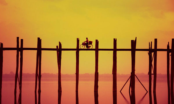
Overland by car to Machambaw 14 miles takes an hour. The road passing through flat area and some villages. At the end of the grass and paddy fields, it is Malikha River. Machambaw is on the other side of river and crossing over the rattan suspension bridge and hike to Machambaw half a mile. Machambaw is a nice little town on the bank of Malikha River with beautiful sceneries. The native people are Rawan, Lisu and Kachin races. Overnight at Gubar Guest house.
Day 2: Machambaw - Namkham
It is only 8 miles away from Machambaw to Namkham and an easy hike through the flat area. Hiking will take nearly 4 hours, passing through InnBo, Maikaw and MaBuKaw villages. Namkham is a big village with more than an hundred households. Overnight at village houses.
Day 3: Namkham - Namhti
Soon after leaving from Namkham, crossing a creek and began up trekking. The path has many up and down along the way and Namkham to Namhti is 13 mile long. Namkham village is located at over 1000 feet and Namhti guesthouse is located at over 2000 feet above the sea. The forest is thick and green and lush. After trekking 9 miles from Namkham, there is a Namhti creek crossing over suspension bridge and get to Namhti lower guesthouse on the other side. Then trek up hill about two and half hour will get you upper rest-house of Namhti. Today trekking will take approximately 8 hours. Overnight at Namhti Upper rest-house.
Day 4: Namhti - Maza
Maza is 9 mile away from Namhti and 5 miles is up trekking. Today you are crossing over BarbuLonHtan (over 6000 feet) Mountain at the high of 5200 feet. The view from mountaintop is scenery but it is visible when weather is good. After up way trekking mountaintop, all the way down to Maza guesthouse. The regular footpath is more winding and turns but easy to go. There are short cuts along the way but steep and small stones that make easy to fallen down. There is Maza rest-house and other house of watchman. You are now at 2300 feet (699 meter) above sea. Today trekking will take approximately 7 hours. Overnight at Maza rest-house.
Day 5: Maza - NaungMon
NaungMon is 9 mile away from Maza. 5 miles is up and down trekking and the rest 4 miles is hiking in flat area along KasanKa River. There is a suspension bridge crossing over KasanKa River to get into NaungMon town. NaungMon town is situated in 1798 feet above sea and a northern extreme township in Myanmar. The town is surrounded by Mountain ranges. There is a market, a hospital in town where is the last point to buy some more food and gears for further trip. After NaungMon, there are only small villages and rest-houses. And also porters from Putao are going to return and will need to gather new porters from NaungMon. Most of native people do not used to travel if they do not know the area very well. There may be one or two porter who is willing to go further trip. Overnight at township hall.
Day 6: NaungMon - Guttu village
Guttu village is 13 miles away from NaungMon. There is a Yatbot village after 9 miles hiking from NaungMon along KasanKa River. There is a suspension bridge to Yatbot village on the other side of KasanKa River.
Guttu village is 1730 feet (526 meter) above sea. Overnight at village houses.
Day 7: Guttu - Kawletu village
Kawletu village is 12 miles away from Guttu village. There is Lansar village after 4 miles and Chalkan village at 6 mile away from Guttu. The path is good to travel only in dry season and when it is raining the road is muddiest one. After half way, there is a mountain cut to get into a village called Lon Paw. Continue up hiking until Kawletu village 650 meter above sea for overnight stop. The whole village is full of mud during raining season.
Day 8: Kawletu - Sin Shan rest house
Trekking about 9 miles today. Up hill trekking began after 2 mile hiking in flat road and crossing a river over suspension bridge. Trek up to over 2000 feet and then trekking along ranges up and down. On the way, you will pass by Sanyar waterfall 200 feet high and cross Sanyar creek over a bamboo bridge. Sin Shan rest house is located on a mountain ridge at 1120 meter above sea between two rivers, Malikha River in east and KasanKa River in west. Overnight at Sin Shan rest house.
Day 9: Sin Shan rest house - Pan Nan Din village
It is only 6 miles away. In the morning began trekking up Paik Pyi Razi Mountain (2050 meter). Crossing over the top part of mountain through thick forest. It is snowing at summit area. Passing over summit, it is an easy down trek along flat slope of mountain until Maykha River. Hiking up along the river till a suspension bridge crossing over Maykha River. Rest house is situated near bridge and Pan Nan Din village is half mile away from rest house. The road is rather slippery when it is raining. Overnight at Pan Nan Din rest house.
Day 10: Pan Nan Din - Lon Nat rest house
It is 7 and half miles between Pan Nan Din and Lon Nat rest house. Hiking along Maykha riverbank, sometime on a mountain ridges and sometime on a cliff. The footpath is sometime very narrow as one feet wide and soft soil. Lon Nat rest house is located at 930 meter above sea. Overnight at rest house.
Day 11: Lon Nat - Nga Wor village
About same distance and path condition as yesterday. The path has many small stones make slippery walking.
Hiking along Maykha riverbank, sometime on a mountain ridges and sometime on a cliff. There are nearly 20 households in Nga Wor village situated on a flat ground at 1040 meter above sea level. There are paddy fields and available to buy some rice in that village. There are 2 creeks to cross over before Nga Wor village and if there are no suspension bridges, have to go in the water. Overnight at village houses and camps.
Day 12: Nga Wor village - Wun Si Wun rest house
9 miles trekking from 1040 to 1100 meter today. There is Ta Yon River on the way and crossing over cane suspension bridge. There are 4 farming tents near rest house.
Day 13: Wun Si Wun rest house - Ga Wai village
Ga Wai village is 6 mile away from Wun Si Wun. Crossing a creek few minutes from Wun Si Wun. Trekking up and down hill for half way and other half is walking on mountain range and valley. The village is situated at 1130 meter above sea level and over 10 houses in that village. Overnight at village houses and camps.
Day 14: Ga Wai village - Da Zon Dun village
It is about 11 miles to travel today. It is easy walking in the beginning and the rest is difficult trekking. You need to cross 3 small rivers before crossing Sein Ku Wun River over suspension bridge. Da Zon Dun village is located at 1230 meter above sea level and near by the Sein Ku Wun River. It is confluence of Sein Ku Wun River and AdornWun River near that village to become a famous river "Maykha'' of mighty Ayeyarwaddy River. Overnight at camps.
Day 15: Da Zon Dan - Ta Su Htu village
Only 6 miles will move out today. The village Ta Su Htu is located at the confluence of Ta Wor Shan River and AdornWun River. Crossing over a bridge to get to village. You are at 1310 meter above sea. Overnight at village.
Day 16: Ta Su Htu village - Crown (a) Adorn Dun village
It is only 6 miles travel again. You are passing through Ta Lar Tu village on the way. The scenery is changing one mile after another. Pine trees can be seen from now on and terrace-firms near the village. The village is situated in the eastern bank of AdornWun River and will be going to village over a bridge. A visit to Crown village will be unique experience to see the Htayon tribe of dwarfs about 15 people only left today. Villagers from that village plant only wheat, maze and corn. They do not eat rice. Before Crown village, there are Inn Bo, Maikau and Mabu villages on the way. Overnight at the village of Dwarfs.
Day 17: Crown - Ta Haung Dun village
Today travelling for 4 miles only. Slow and easy hiking with beautiful sceneries along AdornWun River. Crossing over a suspension bridge to Ta Haung Dun village situated at 1780 meter above sea. There are 8 houses constructed with wood logs and a Buddhist monastery. It is a village of Tibet ancestor.
This village is the last village on the way to Mt Khakarborazi. Porters from NaungMon village will be returning to home and renting new porters from Ta Su Htu, Crown and Ta Haung Dun villages.
Day 18: Ta Haung Dun - Ka Man camp
Trekking up and down hill along a creek. Trekking will take about 7 hours for 4 miles. The camp is near by the river. Overnight at Ka Man camp.
Day 19: Ka Man - Na Ya Don camp
Trekking for 7 miles today. Weather and forest changed. Na Ya Don camp is situated at 2370 meter above sea level.
Day 20: Na Ya Don camp - Ta Li Htu camp
Trekking for 7 miles again today. The path is full of bushes and berry plants that have to be cut for a way.
Ta Li Htu camp is in 2545 meter above sea. There is a small flat ground to pitch camps.
Day 21: Ta Li Htu - Ya San Dun camp
Today trekking for 8 miles. There are two bridges along the way. The bridges are made of single log to cross over Ta Li creek and Ma Laung Wun creek. Many pines trees and bamboo are growing along the way. Ya San Dun camp is in 2920 meter above sea and fare large place for pitching camp.
Day 22: Ya San Dun - Ya San San camp (Base camp
Trekking along Ya San Wun creek, which is a tributary of Ma Laung Wun River. Ya San San camp is at the confluence of Ya San Wun and Ahtan Bon Wor creeks at the high of 3050 above sea.
Day 23: Ya San San camp - Mt Khakarborazi base camp
Today trekking for 12 miles along the creeks. A journey walking on rocks and stones. When you get closer to Base camp, only small pine trees and Juniper are growing. About a mile before base camp, there is neither a single plant nor a piece of wood for fire.
Base camp to Summit
If the weather is good situation in allowing for mountaineering, at least 12 days for very good mountaineer from Base camp to summit and return. Weather is changing hourly. If you will be mountaineering to summit, it is necessary to make 2 groups. A front crew will carry all gears and food to use in Base camp and mountaineers will follow 3 to 5 days later. The best time for mountaineering is leaving from Putao in last week of July.
Mt. Khakarborazi trekking trip is available
If you would like to do trekking trip, this trip will take you up to the village of Ta Haung Dun; it is a village of Tibet ancestor and Crown village of the Htayon tribe of dwarfs.
The best time for only trekking is in first week of November.
